I always forget it is simply sf::read_sf to read .kml files into R. That is, until it isn't. There are few instances where sf::read_sf behaves strangely. Mostly when attempting to read .kmz's or files with multiple layers.
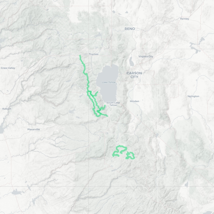
For this post I've created a few .kml and .kmz files to use as an example, download them here. They are hiking trails or routes that I've been on in the past, or plan on hiking at some point. See the map below for a visual of the routes.
Setup
It is always best to set up your R workspace before starting a project. I like to create a new RProject if I know I'll be revisiting this project in the future. The easiest way to do this is to click the little blue box in RStudio shortcut bar. Or File > New Project... from the menu bar.
Once you've done that, load the following libraries. If you don't have them installed, uncomment the first line of code in the snippet below and run it.
# install.packages(c('sf', 'fs', 'magrittr', 'leaflet'))

library(sf)
library(fs)
library(magrittr)
library(leaflet)
All the code is on GitHub in an effort to make this small project more reproducible. Clone, fork, or star if you would like to. Contributions welcome!
Read .kml
This one is easy, sf::read_sf and that is it. The data is all there as expected.
library(sf)

routes_sf_1 <- read_sf('data/routes.kml')
routes_sf_1

# truncated R output
#> Simple feature collection with 4 features and 2 fields
#> geometry type:  MULTILINESTRING
#> dimension:      XYZ
#> bbox:           xmin: -120.3272 ymin: 38.49434 xmax: -119.7678 ymax: 39.31636
#> epsg (SRID):    4326
#> proj4string:    +proj=longlat +datum=WGS84 +no_defs
#> # A tibble: 4 x 3
#> ...
Multilayer .kml
What happens when you try and read a .kml with multiple layers? {sf::read_sf} will warn that the input contains multiple layers, and only the first layer is used. In this case only 2 routes, the first layer, is loaded into R.
routes_sf_2 <- read_sf('data/routes-multi.kml')
#> Warning message:
#> In evalq((function (..., call. = TRUE, immediate. = FALSE, noBreaks. = FALSE,  :
#>   automatically selected the first layer in a data source containing more than one.

# check the sf object
routes_sf_2

# truncated input
#> Simple feature collection with 2 features and 2 fields
#> geometry type:  MULTILINESTRING
#> dimension:      XYZ
#> bbox:           xmin: -120.3272 ymin: 38.83353 xmax: -120.044 ymax: 39.31636
#> epsg (SRID):    4326
#> proj4string:    +proj=longlat +datum=WGS84 +no_defs
#> # A tibble: 2 x 3
I didn't even know it was possible to save multi-layer .kml files. If you are familiar with Google Earth you can create folders to better organize your places. When these folders are nested it is possible to create a .kml that is has multiple layers. routes-multi.kml has two layers, north and south. Each layer has two features. Keep this in mind as you work through the next code block. With a little effort it is possible to load all the layers into R at once.
input_file <- 'multi-layer.kml'

# get the layers in the kml
(kml_layers <- st_layers(input_file))

# output of kml_layers
#> Driver: KML
#> Available layers:
#>   layer_name        geometry_type features fields
#> 1      north 3D Multi Line String        2      2
#> 2      south 3D Multi Line String        2      2

# iterate over layers, and read in idividually
# I always reach for lapply in these instances
routes_list <- lapply(kml_layers$name, function(x) {
  read_sf(input_file, layer = x)
})

# then rbind each element of the list together with Reduce
routes_sf_2 <- Reduce('rbind', routes_list)

# check for equality between routes
assertthat::are_equal(routes_sf_1, routes_sf_2)
#> [1] TRUE
Let's walk through this code step by step.
- The input file is used multiple times, save it to the
input_filevariable to avoid repitition. sf::st_layersreturns a list-like object of all the layers in a spatial file. In this case there are 2 layers. The name of each layer can be extracted from this object withkml_layers$name- Now iterate over each layer of the
.kmlby using the name of the layer. I almost always uselapplyto iterate, but that isn't the only way to do it, use your favorite iteration method here. This will return a list - each element of the list is ansfobject. - Finally, consecutively
rbindthe elements of the list to each other withReduce- another method I repeatedly reach for!
The result, a single sf object with 4 rows.
Remember, there are multiple methods to iterate in R. The lapply, Reduce is my favorite way to iterate and combine data. I'm very comfortable with how it works. If it seems intimidating use a for loop. There is nothing wrong with for loops. Regardless of what you may have heard about them!
lapply in a single line?
If you're interested, the lapply and Reduce functions can be written in a single line. I opted to not do that above for readability. The choice is yours.
Reduce('rbind', lapply(kml_layers$name, read_sf, dsn = input_file))The gist is that ... passes additional arguments to the function used within lapply. In this case that is the dsn argument in read_sf. Read the lapply documentation for more information.
Read .kmz
This example will depend on the version of gdal installed on your system. If you've only ever installed sf the version of gdal installed will not be able to read .kmz files. This GitHub issue goes into much more detail about why it fails. About 12 comments in @edzer provides a solution. It's a manual solutions. But we are programmers! We can code a solution!
# try and read a .kmz with read_sf
input_file <- 'data/routes.kmz'
read_sf(input_file)

# error message output
#> Error: Cannot open "C:\Users\mgritts\Documents\routes.kmz";
#>    The source could be corrupt or not supported. See `st_drivers()`
#>    for a list of supported formats.

# a workaround
input_file <- 'data/routes.kmz'
read_sf(input_file)

# workaround
target_file <- 'data/.temp.kml.zip'
fs::file_copy(input_file, target_file)
unzip(target_file, )

# read as kml now
(routes_sf_3 <- read_sf('doc.kml'))

# check for equality between routes
assertthat::are_equal(routes_sf_1, routes_sf_3)

# cleanup the temp files
fs::file_delete(target_file)
fs::file_delete('doc.kml')
If you don't get an error after the first line in the code above, congratulations! Your gdal installation is better than mine.
If you do get an error, use the workaround. Yes, I know it might be confusing to use a library called {fs} and a library called {sf}. Try and remember sf = simple features, and fs = file system.
Try this next exercise on your own. Load the multi-layer .kmz file into R. Here are a few hints:
- Treat it like a single layer
.kmz. - Once it is unzipped you can treat it as a
.kml. - remember to cleanup after yourself!
Encapsulate it
That seems like an awful lot to think about every time a .kml or .kmz needs to be loaded into R. There is duplicate code, lots of typing, iterating, etc. This is a perfect opportunity to think about encapsulating the logic of reading .kml's.
Writing functions is more art than science. I'll show you how I've decided to write the function below. I encourage you to think about how you might do it before checking my solution. Remember, there isn't a single, correct answer.
KML stands for keyhole markup language. I think I'll call the function read_keyole since it will work for .kml or .kmz files.
read_keyhole <- function(file) {
  # get file extension
  ext <- strsplit(basename(file), split = '\\.')[[1]][-1]

  # if kml
  if (ext == 'kml') {
    layers <- st_layers(file)$name

    if (length(layers) > 1) {
      return(Reduce('rbind', lapply(layers, sf::read_sf, dsn = file)))
    }

    return(read_sf(file))
  } else {
    target_file <- '.temp.kml.zip'

    fs::file_copy(file, target_file, overwrite = T)
    unzip(target_file, overwrite = T)

    sf_out <- read_sf('doc.kml')

    fs::file_delete(target_file)
    fs::file_delete('doc.kml')

    return(sf_out)
  }
}

# test function
read_keyhole('data/routes.kml')
read_keyhole('data/routes-multi.kml')
read_keyhole('data/routes.kmz')
Cool, that works! There is a lot that can be done to improve this function. Note that I have not included a solution to load multi-layer .kmz files into R. However, if you solved the homework above, you can try pluging that solution into this function.
Wrap Up
Every once in a while I find problems like this that I must solve, I can't help it. In this instance, I needed to import many separate .kml or .kmz files into ArcGIS Pro. Many times the imported file wouldn't display properly. And I was only able to do one at a time, a slow and tedious process. I figured I could speed this up with R by iterating over all the files in a directory, loading the contents, then exporting all the spatial data as a geopackage. That's when I discovered the problem with multi-layer .kml files.
My initial solution was very similar to the process outlined in this post. I hard coded a solution. I eventually realized that it will be useful to encapsulate all the logic into a function for better reuse. Maybe I'll only use that function a few times a year? But I won't ever have to figure out this process of loading .kml files again, thanks to the function (and this post)!
FYI
There is probably a package out there that solves this problem, likely in a much more battle-tested way. I'll be honest, I didn't do much research. This was one of those times I stumbled upon a problem and decided to "scratch my own itch". That is one of the great things about learning to program. Find a problem, think of a solution, code the solution (rinse and repeat until the problem is solved).
Even if a solution already exists I look at situations like this as opportunities to practice. Think of it as an exercise in problem solving. Or maybe just stubbornness. Regardless, I am always looking for situations to improve my skills. I happened to get lucky, yes lucky, when I stumbled upon this opportunity to practice problem solving.